

Saint-Floret
Auvergne-Rhône-Alpes, Puy-de-Dôme
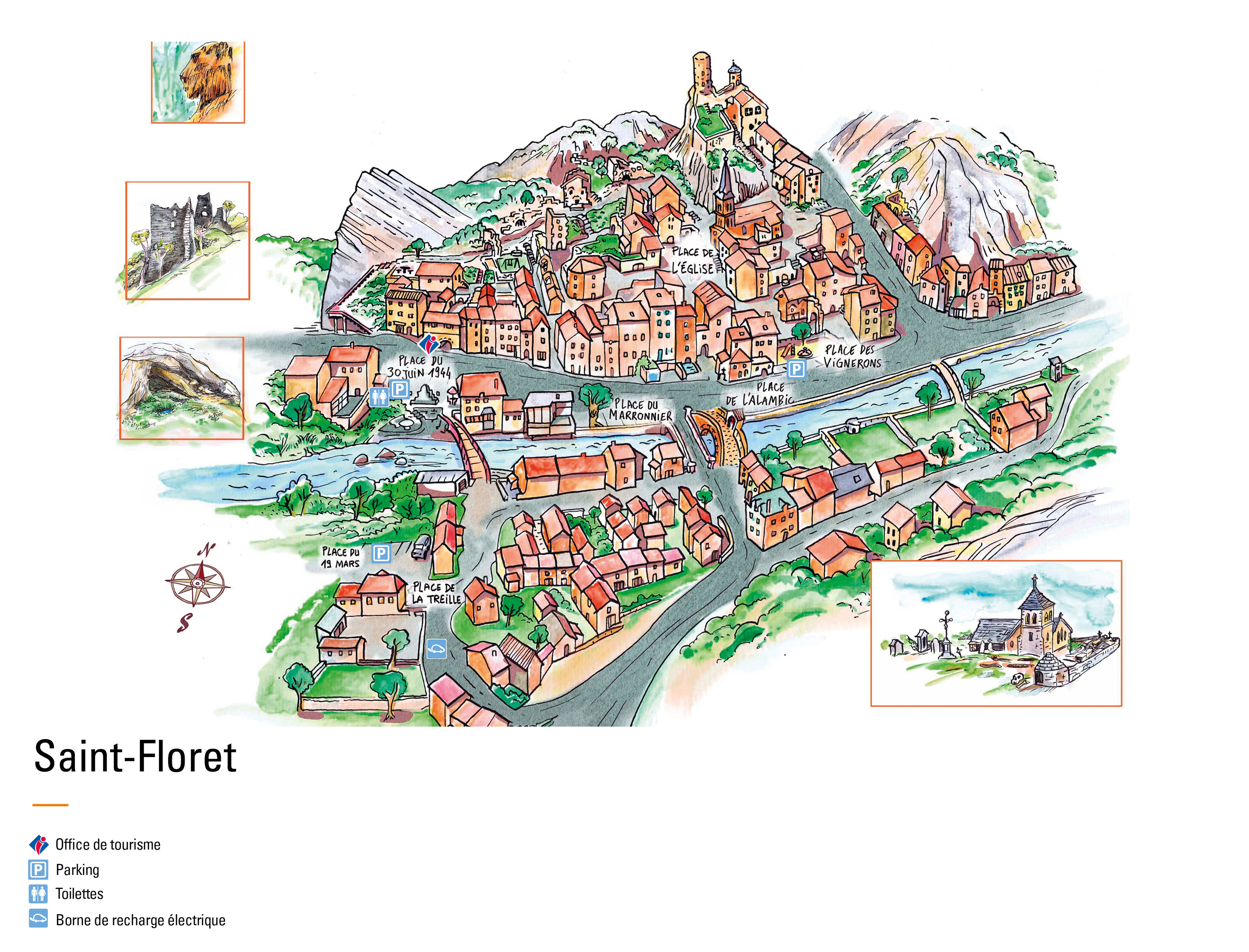
Saint-Floret, Petite Cité De Caractère®
Saint-Floret is designated Petite Cité de Caractère®. As such, it forms part of a national project aimed at promoting and protecting the architectural heritage of little towns across France. Through tourism, the initiative encourages visitors to embrace the local culture by strolling through the streets, learning about the history of the area, taking part in local events, and discovering the local way of life. In Puy-de-Dôme, there are several Petite Cité de Caractère® little towns to discover. The digital map will help you navigate each of them and highlight their main attractions.
Presentation
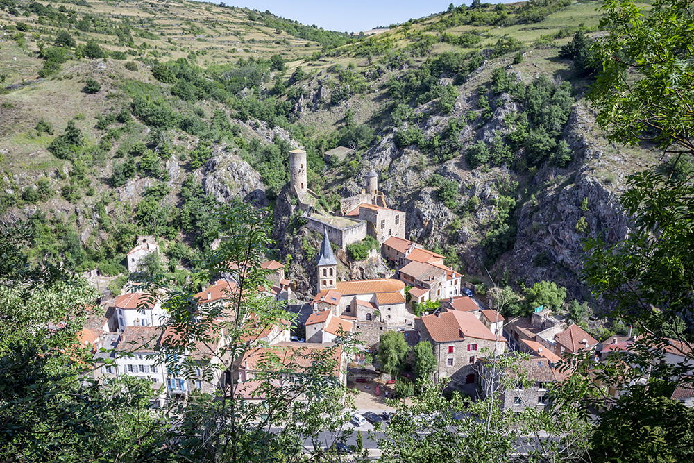
The town of Saint-Floret is a long village surrounded by granite rock and crossed by the turbulent Couze Pavin river. The castle and Romanesque church were initially constructed on the Chastel hill for purely military purposes. The Château de Chastel offers a panoramic view of the village. The site comprises a 12th- and 13th-century chapel, with its 16th-century bell tower, and is surrounded by the village cemetery.
History of the Castle

In the mid-15th century, Guillaume Revel published a representation of the castle complex and village of Saint-Floret in the Armorial d'Auvergne, Bourbonnais et Forez, which can be compared with the current remains. The structure depicted features a crenellated enclosure, fortified by two towers on the western side, encircling a residential building and a circular keep crowned with a wooden roof and a conical roof. A third tower is visible behind the church. The second primary structure extends beneath the rocky spur.
The keep
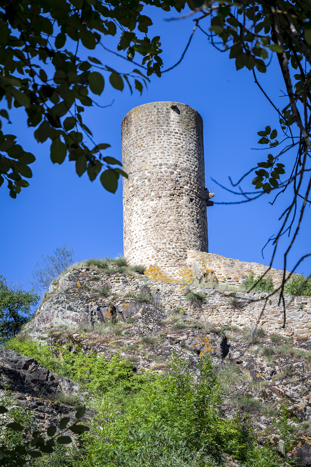
The keep, a circular tower, is the most prominent feature of the complex. The structure comprises three levels, the first of which is carved into the rock. The south-eastern part of the structure features two superimposed doors. The limited interior space and absence of apertures appear to indicate a military function.
Fresco room
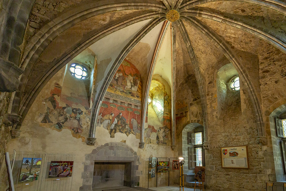
In honour of the Duke of Berry, we present an exceptional painted decoration dating from 1360-1370, which was listed as a historic monument in 1909. It is the most significant evocation of a chivalric novel and the sole representation in France of the Roman de Tristan et Iseut, which was extremely popular during the Middle Ages.
Ornament Room

The room has been carefully preserved, with original tiling and a remarkable roof structure still in place.
View over the village
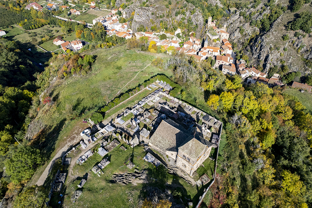
From the vantage point of the platform, one can enjoy a breathtaking vista of the village, the ruins, and the Chastel hill.
Archaeological site

The first occupation of this site dates back to protohistory and continued until medieval times. The name Chastel is derived from the term Castellum, which was used by the Merovingians to denote 'a fortified place on a naturally defended site'. Consequently, the first 'castle', or Chastel, is believed to have been constructed during this period.
Church and its 13th-century fresco
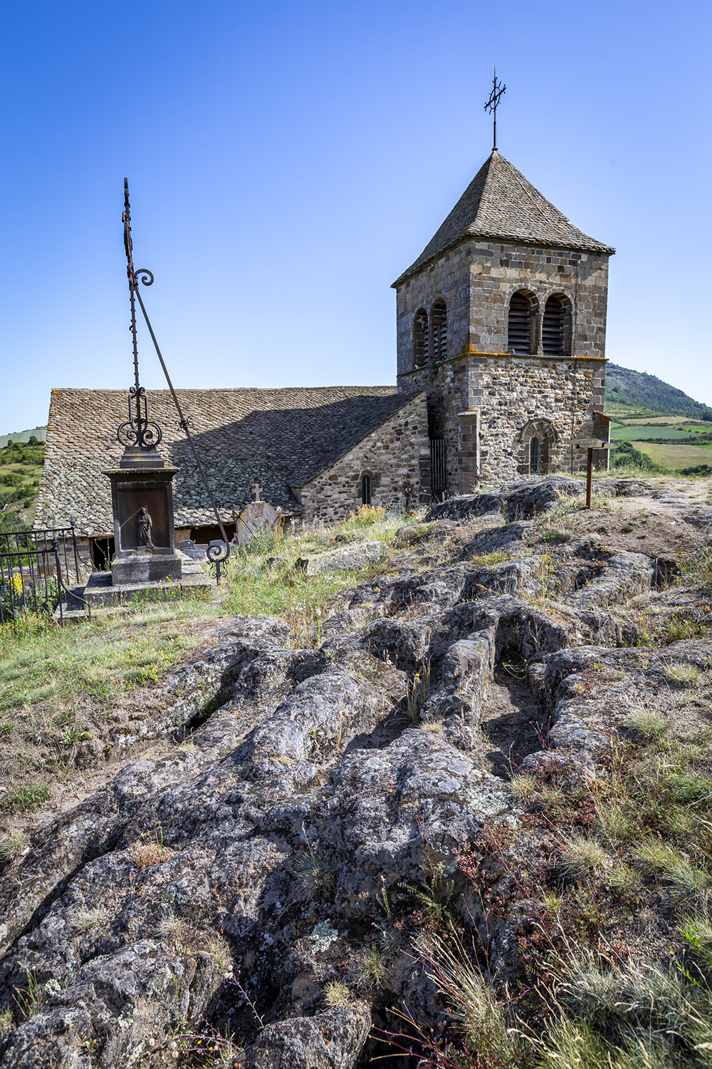
In the tradition of rural Romanesque churches of Auvergne, the church is dedicated to Saint-Flour, one of the first bishops of Auvergne, hence the commune's name. The 12th-century Romanesque building has a slate tile roof; its 13th-century reconstruction, confirmed by historical data, follows the plan of the original castle church, with Gothic decorative elements. At the sacristy entrance, a 14th-century Virgin and Child in Nonette marble shows Jesus caressing a bird with his foot. A mural in the 14th-century north chapel, unrestored, whitewash removed, depicts Jehan de Bellenaves, Lord of St Floret, his second wife Isabeau de Chalus and their four children (Pierre, Athon, Galiane, Eléonore) presented to the Virgin and Child by Saint John the Baptist. A replica is at the Palais de Chaillot, Paris. Inside: a funeral litter, a paperolle and a 17th-century flamboyant Gothic altar.
Ossuary
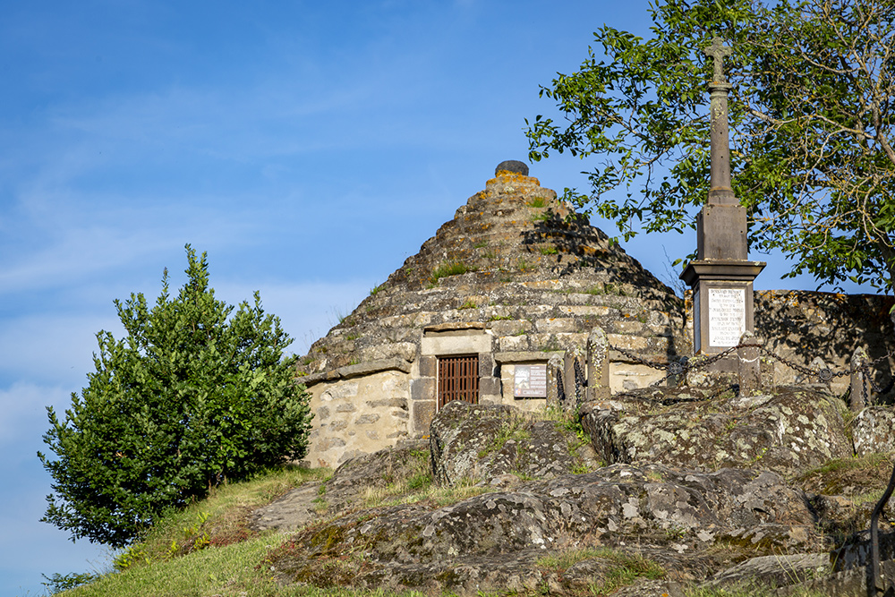
The discovery of an ossuary at the site, with a well dating back to the 1st century AD, indicates that humans recognised the area's potential as a location for habitation from an early period. The circular building has a diameter of 9 metres and a stepped roof topped with a spherical volcanic stone. The property was restored in 1923. Internally, the dome is decorated in a similar manner to that of the 13th-century church, with faux ochre and red stonework, and five-petalled flowers. In medieval times, ossuaries were used for the management of bodies. The church and ossuary were designated historic monuments by decree on 19 April 1915, and the mural in the Church of Le Chastel was listed as a historic monument in 1914.
Anthropomorphic tombs
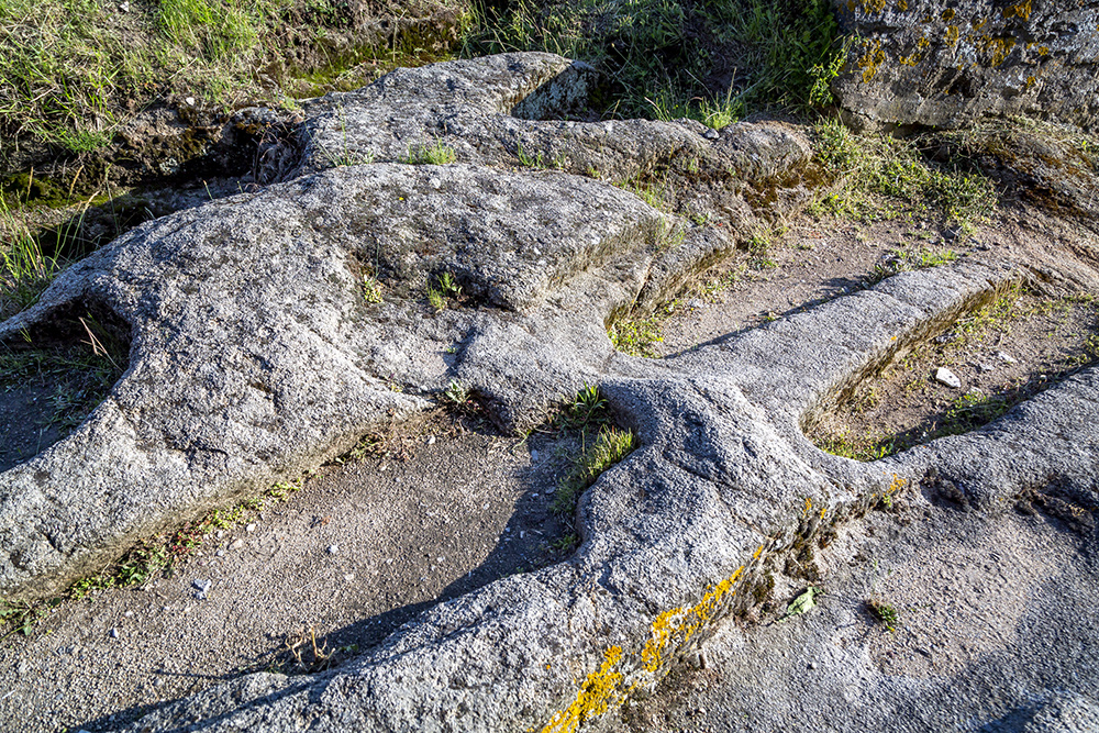
These tombs were excavated into the granite rock face during the Merovingian period. Their shapes bear a striking resemblance to those of human bodies. Twenty-two anthropomorphic rock tombs, dug into the granite of the Chastel rock, have been uncovered, including two for children. The Omega-shaped cephalic cavity and dovetail joint are oriented with the head to the west and the feet to the east. The bodies of the deceased are located directly in the tombs, which are closed by slabs (mainly basalt, but also limestone and granite) that fit into the rebates. It appears that some of these have been closed with perishable materials. Of the 22 graves examined, 10 contained skeletons with heights ranging from 1.60 m to 1.92 m. It was established that no objects were present in the graves apart from one with beads (bracelet/rosary). Genetic abnormalities were identified in some of the skeletons.
View of the village, castle and Sancy mountains
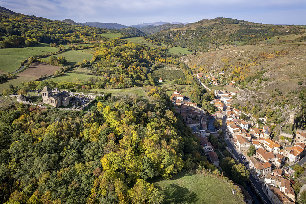
The Château de Chastel offers panoramic views of the village and the castle, the Couze Pavin valley as far as Issoire, and the Sancy massif.
Entrance to the fort
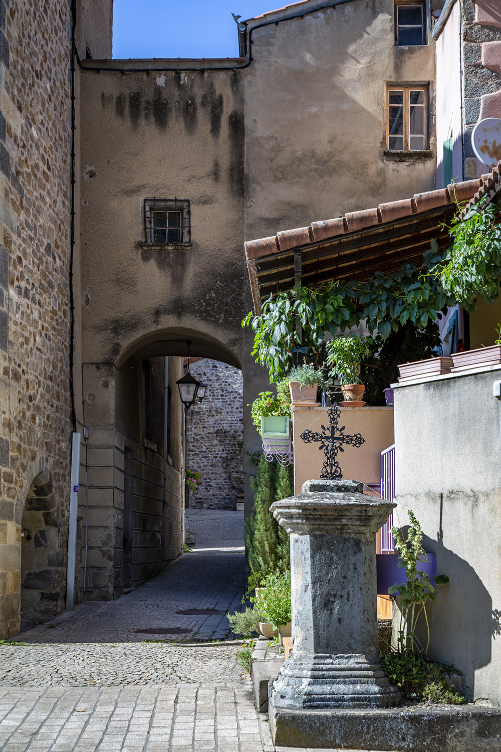
The entrance to the fort is located near the medieval bridge. As the most important part of the village, the fort's entrance is of great significance. This central area encompasses the church and its presbytery. The neighbourhood retains many architectural features that evoke the state of the fort as we imagine it, with its tightly packed houses.
Ruins from 30 June 1944
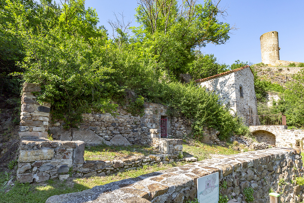
Saint-Floret experienced a period of relative stability until 1944. In response to an attack on a military convoy, the Germans bombed the village on the morning of 30 June. It is with great sadness that we report the death of eleven villagers in the bombing. Villagers and civilians were detained and transferred to the German military prison at 92 in Clermont-Ferrand. On 13 July 1944, six of them were extracted from their cells and executed in Orcines. Six inhabitants were deported, three of whom died during the process, and three returned. A significant proportion of the old town and the fort were destroyed. The municipality has recently undertaken a programme of development and safety measures in these areas.
Oratory of the Virgin's Bridge
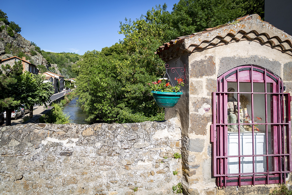
In the village, the oratory of the 'la Pède' bridge, which spans the Couze Pavin, houses a polychrome carved wooden Virgin in Majesty. Dating from the 13th century, it is one of the archetypal Virgins in Majesty of the Auvergne from the Romanesque period. Local residents believe that during the bombing, this Virgin protected the two bridges because the bomb that fell crashed between them without exploding.
Vine Museum and the Museum of Rural Life

Vine Museum - In the 19th century, Puy de Dôme was third among French producers of wine. This entire heritage is reflected in an authentic wine cellar, where each tool on display bears witness to the hard work of the winegrowers at a time when men toiled tirelessly. The museum, which opened in 2022, has been awarded official certification by the Ministry of Agriculture. The Museum of Rural Life explores the entire process of agriculture, from the initial sowing of seeds to the final harvesting of crops. This second museum offers a nostalgic glimpse into a world of work that is more than a century old, providing a poignant reminder of a bygone era.
Fairy Cave Fountain

Mineral springs with cold, acidic waters have been shown to have a beneficial effect on intestinal diseases in children.
Lower church
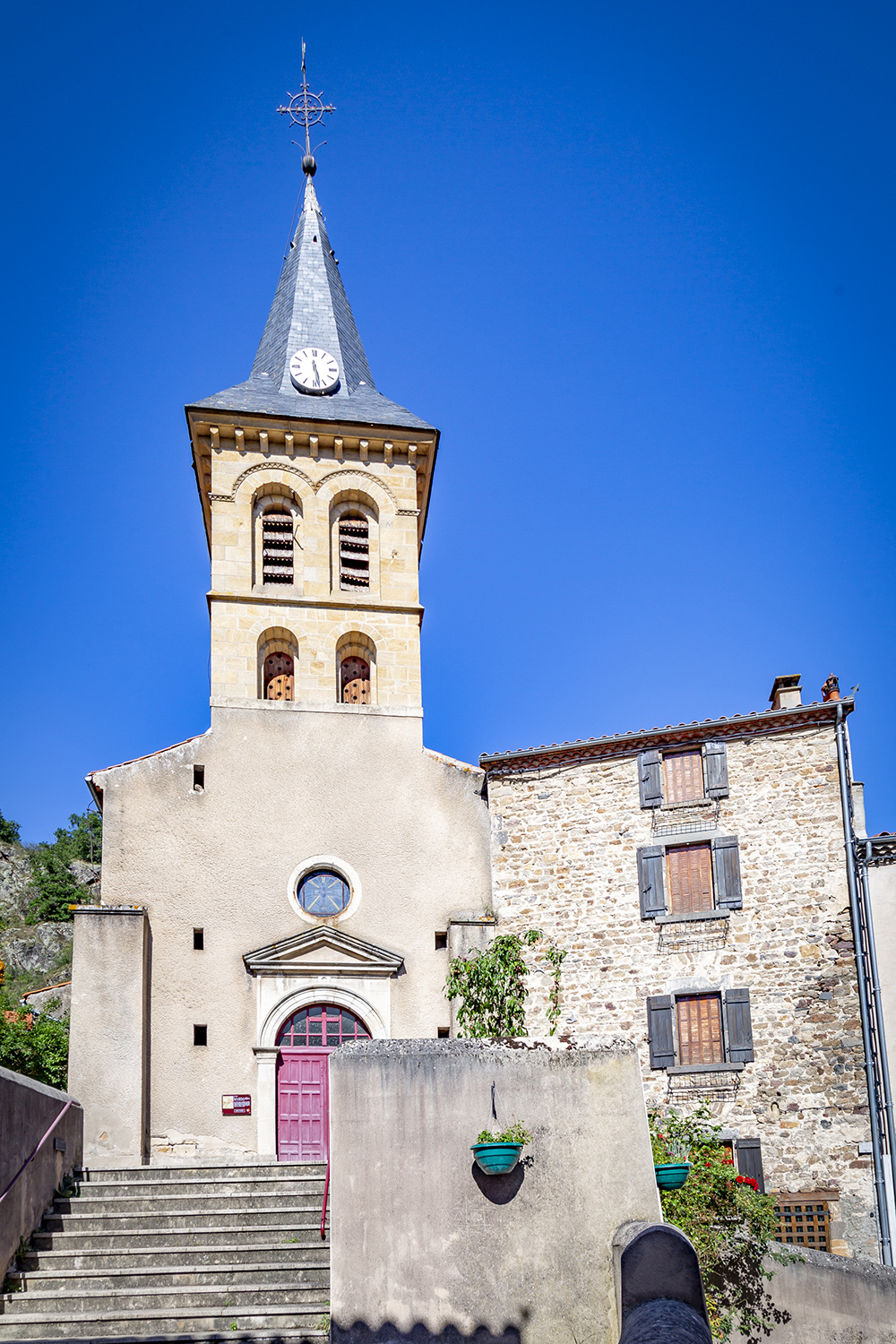
The structure was constructed in the 18th century, with the bell tower added in the 19th. The furnishings are in the Baroque style. 16
The lion's head
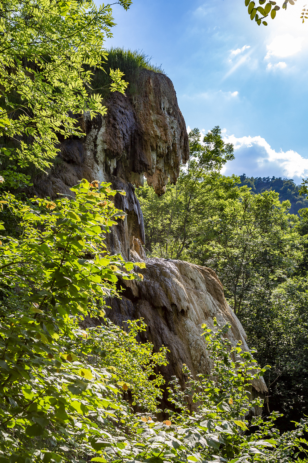
Of the 600 mineral springs found in the Auvergne region, Saint-Floret is undoubtedly the most impressive. Its most notable feature is its unique shape, which is attributed to the mineralisation of the water. The 'Lion's Head' is composed of a rock called travertine, which is the result of continuous deposition of limestone carried by water. It is located 2 kilometres from the village.
Rambaud Castle
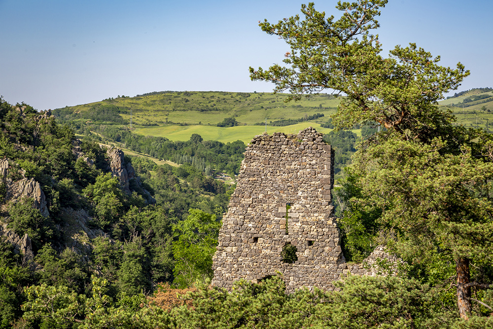
Situated in proximity to the Lion's Head spring, this fortification served as a military outpost with a communication network extending to the castle of Saint-Floret. Only the remains of a section of wall are still visible. The building measured 10 metres in width and 16 metres in length, featuring a semi-circular tower.

Ce projet de carte interactive est porté par les associations Petites Cités de Caractère® de France, Petites Cités de Caractère® en Auvergne Rhône Alpes Petites Cités de Caractère® du Puy-de-Dôme et par la commune de Saint-Floret.
Il est soutenu financièrement par la convention FNADT du Commissariat Massif Central, et par l'appel à projet "patrimoine et numérique" de la Région Auvergne Rhône-Alpes, et par la Fondation d’Entreprises du Crédit Agricole Centre France.
Le plan de la commune (visuel de fond) a été réalisé par Lemoineau.
Les traductions en anglais ont été réalisées par Kim Spychalski.
Les voix ont été produites et enregistrées par Marie Léger (version française), Tamara Souverain (version anglaise).
Les photos ont été produites et réalisées par Julie Baudin, Etienne Barathon, Baptiste Carrat et la Mairie de Saint-Floret. Les photographies réalisées par Julie Baudin ont été subventionnées par le Conseil départemental du Puy-de-Dôme.
Les vidéos ont été produites et réalisées par Petites Cités de Caractère®.
Conception et développement de la carte interactive par Tabula Rasa.




Ce projet de carte interactive est porté par les associations Petites Cités de Caractère® de France, Petites Cités de Caractère® en Auvergne Rhône Alpes Petites Cités de Caractère® du Puy-de-Dôme et par la commune de Saint-Floret.
Il est soutenu financièrement par la convention FNADT du Commissariat Massif Central, et par l'appel à projet "patrimoine et numérique" de la Région Auvergne Rhône-Alpes, et par la Fondation d’Entreprises du Crédit Agricole Centre France.
Le plan de la commune (visuel de fond) a été réalisé par Lemoineau.
Les traductions en anglais ont été réalisées par Kim Spychalski.
Les voix ont été produites et enregistrées par Marie Léger (version française), Tamara Souverain (version anglaise).
Les photos ont été produites et réalisées par Julie Baudin, Etienne Barathon, Baptiste Carrat et la Mairie de Saint-Floret. Les photographies réalisées par Julie Baudin ont été subventionnées par le Conseil départemental du Puy-de-Dôme.
Les vidéos ont été produites et réalisées par Petites Cités de Caractère®.
Conception et développement de la carte interactive par Tabula Rasa.